The How Brickworks, Berman Park
Berman Park in St Ives opened in March 2021 on part of the former golf course between the Thicket Path and the St Ivo Recreation Centre. It is hard to imagine that two hundred years ago the area was a thriving brickworks. Read on to learn about the brickworks and other features in Berman Park in this article from landscape historian Keith Grimwade.
Landscape features in Berman Park
 |
| Landscape features in Berman Park, St Ives. |
You may already enjoy walking in Berman Park. The vistas and habitat are tranquil. Did you realise history surrounds you? The Thicket Path bordering the southern edge is more than one thousand years old. Look closely and you'll notice undulations in the northern part of the park. Ridge and furrow features date from the 11th century. For a photograph indicating ridge and furrow features in Berman Park, click here.
The How Brickworks
The most important historical activity in the area was brickmaking. The earliest evidence in St Ives is traces of digging for clay along the edge of How Hill to fill timber frame houses in the 16th century. The first evidence of an industrial brickworks is on Edmund Pettis’s 1728 map of St Ives which shows two brick kilns in ‘Brick Kiln How’.
The site was chosen for brickmaking because the underlying rock is good quality Oxford Clay, it is next to the river for transport and there was a demand for bricks as St Ives replaced its wooden buildings with brick ones.
The site of one of these kilns can still be seen next to the Thicket Path, shown above. It is almost certain that the brickworks began in the late 17th century because older buildings and walls in the town have soft, red 2 inch bricks, made from local clay. These went out of use following an Act of Parliament in 1725 that standardised the thickness of bricks at 2.5 inches. The above image of Wellington Street, near the Quay, shows where you can still see some of the 2 inch bricks.
Richard Harraden’s print of 1802 is one of the earliest illustrations of St Ives and shows how much the brickworks had grown in the 18th century. The site is dominated by sheds where the clay would have been mixed with water, moulded into bricks and dried. A stack of bricks is waiting to be moved to the kiln.
An indication of the brickwork’s productivity is that in 1822 John Margetts produced 1.25 million bricks for the construction of the New Bridges Causeway, linking the Old Bridge with London Road. Later that year John retired and the brick kiln's lease was auctioned.
At the height of production the brickworks had a big impact on the western edge of the town. John Skeeles writes in his Notes on the History of St Ives:
Naturally the working of the yard by carting, wheeling silt, coals, bricks etc. to and from the barges detracted from the pleasure of walks to The Thicket. Also the dense clouds of sulphurous smoke from the open kilns were a nuisance to the How House.
 |
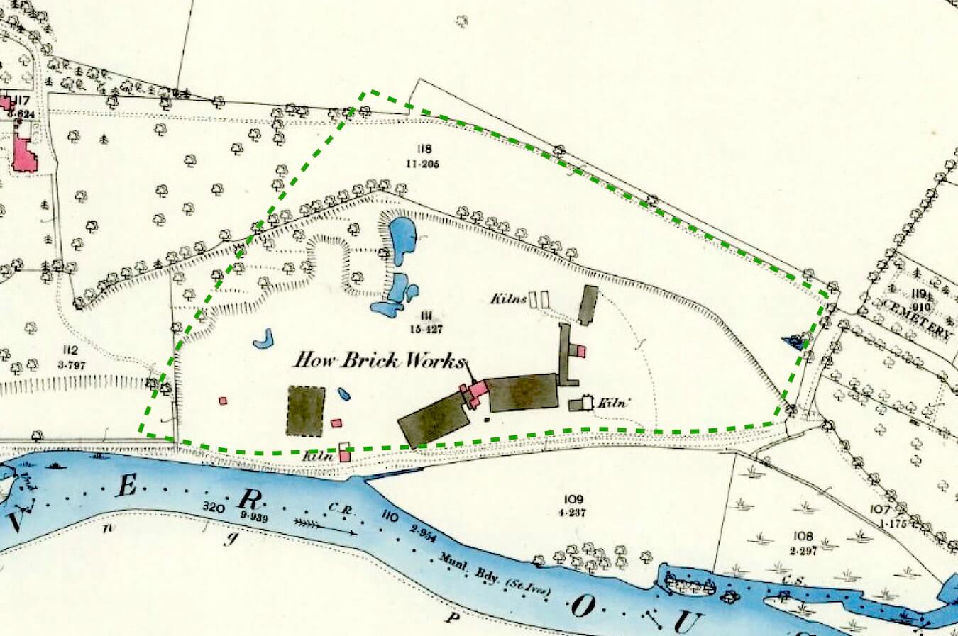
| How Brickworks map, 1886. The boundary of Berman Park is marked out in green. |
The first large scale Ordnance Survey map published in 1886 shows that the site had developed eastwards, with new kilns being built. The brickworks closed in 1888. The best quality clay had been exhausted. Although steam power had been introduced, there was competition from larger, more mechanised brickworks.
The 1881 census for St Ives records that Walton Gaylott, the foreman of the brickyards, lived in Church Street, at the end of Thicket Lane. By the next census in 1891 the site had been cleared and given over to cattle grazing. In 1923 it was purchased by the St Ives Golf Club, who played there until 2010. Now a peaceful country park, its former existence as the town’s main brickworks is very much in the past, but not forgotten.


Very interesting read. Just to nit-pick it’s Edmund Pettis, not William! Lesley
ReplyDelete